

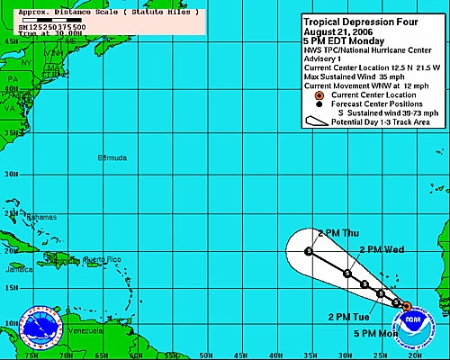
The National Hurricane Center and the Central Pacific Hurricane Center reported Friday that Hurricane Fausto has intensified into a Category 2 storm in the eastern Pacific Ocean, prompting meteorologists to issue early advisories as the system tracks steadily toward the Hawaiian Islands. Maximum sustained winds have reached 100 mph (160 km/h), with forecasters predicting the system will maintain its general westerly trajectory and potentially approach the archipelago early next week.
Context and Environmental Drivers
Pacific hurricane activity typically peaks during late summer when ocean surface temperatures across the equatorial Pacific reach seasonal highs. Warm surface waters provide essential thermal energy, allowing tropical disturbances to organize rapidly into powerful cyclic storms.
While tropical cyclones frequently form off the western coast of Mexico, many weaken significantly as they encounter cooler waters or adverse atmospheric shear in the Central Pacific. However, current satellite monitoring indicates pockets of elevated sea-surface temperatures along Fausto’s projected track, sustaining its intensity longer than average seasonal storms.
Hawaii historically experiences few direct landfall hits from major hurricanes due to the protective effects of localized atmospheric wind shear and surrounding ocean currents. Nevertheless, past brush-by events such as Hurricane Lane in 2018 and Hurricane Dora in 2023 demonstrated that storms passing near the islands can still trigger destructive rainfall, high winds, and dangerous coastal swells.
Storm Metrics and Track Analysis
Satellite telemetry reveals a increasingly structured eye surrounded by deep convective cloud activity extending over 150 nautical miles from the storm center. As of Friday afternoon, Hurricane Fausto was located approximately 1,200 miles east-southeast of Hilo, Hawaii, moving west-northwest at approximately 14 mph.
Meteorologists indicate that atmospheric conditions over the open ocean remain favorable for the storm over the next 48 hours. This atmospheric setup could support additional short-term strengthening before the cyclone encounters more complex atmospheric currents closer to the Hawaiian chain.
The U.S. Coast Guard has issued early safety advisories for commercial maritime traffic and harbor operators throughout Hawaii County, Maui, Oahu, and Kauai. Port officials are urging mariners and commercial vessels to review heavy-weather contingency plans as preliminary swell action begins propagating across regional waters.
Statewide Emergency Planning and Local Response
The Hawaii Emergency Management Agency (HI-EMA) activated preliminary monitoring protocols early Friday, coordinating emergency managers, state transportation agencies, and local public utility providers to prepare response assets.
County emergency officials across the state are advising residents and visitors to review emergency preparedness kits, secure outdoor property, and establish household communication plans. Retailers across Oahu and Maui have reported increased demand for basic supplies, including bottled water, non-perishable foods, portable power stations, and storm shutters.
Regional utility operators, including Hawaiian Electric, have initiated pre-storm grid inspections, clearing tree branches near high-voltage transmission lines and positioning specialized repair crews to mitigate potential grid disruptions caused by high winds.
Expert Perspectives and Predictive Data
Atmospheric scientists note that predicting tropical cyclone impacts near Hawaii involves complex variables, largely due to the terrain interaction caused by the islands’ massive volcanic peaks. Elevations such as Mauna Kea and Mauna Loa can split atmospheric airflow, creating localized pockets of severe wind shear and unpredictable localized rainfall distribution.
“Environmental conditions over the open Pacific are continuing to provide stable fuel for Fausto over the short term,” said Dr. Ellen Vance, a senior meteorological researcher at the Pacific Climate Analysis Institute. “The pivotal variable next week will be how Fausto interacts with an upper-level atmospheric trough approaching from the north, which could either pull the storm northward away from the islands or push it closer to land.”
Data gathered by the National Oceanic and Atmospheric Administration (NOAA) indicates that wave heights near the storm core currently exceed 25 feet. Strong swell activity generated by Fausto is expected to reach east-facing shores across the island chain well before the storm’s main center arrives.
Key Factors to Watch Next
Over the weekend, forecasters will analyze high-altitude data to determine whether Fausto will alter its course or maintain its direct westerly approach toward the Hawaiian archipelago.
Specialized aircraft operated by the NOAA Hurricane Hunters are scheduled to begin reconnaissance flights into the storm’s core starting Saturday afternoon, gathering crucial atmospheric pressure, temperature, and wind data to refine predictive tracking models.
Travelers with plans involving flights or cruises to the Hawaiian region next week should closely track carrier updates for potential scheduling adjustments, delays, or port diversions as environmental conditions evolve.
State emergency officials advise residents to continue checking daily updates from the National Weather Service and local county warning systems, as tropical storm or hurricane watches could be issued across parts of the state over the coming days.





















Leave a Reply